nobletjulien/kosmtik repository overview
Kosmtik


Very lite but extendable mapping framework to create Mapnik ready maps with OpenStreetMap data (and more).
For now, only Carto based projects are supported (with .mml or .yml config), but in the future we hope to plug in MapCSS too.
Alpha version, installable only from source
Lite
Only the core needs:
- project loading
- local configuration management
- tiles server for live feedback when coding
- exports to common formats (Mapnik XML, PNG…)
- hooks everywhere to make easy to extend it with plugins
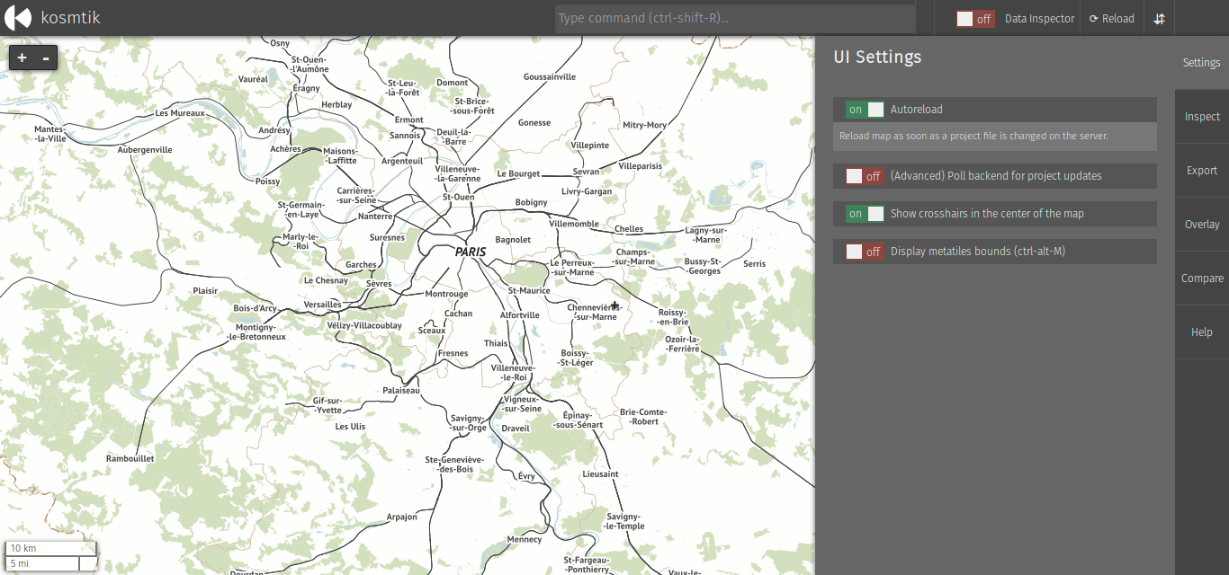
Screenshot
Install
Clone this repository with git clone https://github.com/kosmtik/kosmtik.git,
go to the downloaded directory with cd kosmtik, and run:
npm install
Update
Obtain changes from repository (e.g. git pull)
rm -rf node_modules && npm install
To reinstall all plugins:
node index.js plugins --reinstall
Usage
To get command line help, run:
node index.js -h
To run a Carto project (or .yml, .yaml):
node index.js serve <path/to/your/project.mml>
Then open your browser at http://127.0.0.1:6789/.
You may also want to install plugins. To see the list of available ones, type:
node index.js plugins --available
And then pick one and install it like this:
node index.js plugins --install pluginname
For example:
node index.js plugins --install kosmtik-map-compare [--install kosmtik-overlay…]
Local config
Because you often need to change the project config to match your
local env, for example to adapt the database connection credentials,
kosmtik comes with an internal plugin to manage that. You have two
options: with a json file named localconfig.json, or with a js module
name localconfig.js.
Place your localconfig.js or localconfig.json file in the same directory as your
carto project (or .yml, .yaml).
In both cases, the behaviour is the same, you create some rules to target
the configuration and changes the values. Those rules are started by the
keyword where, and you define which changes to apply using then
keyword. You can also filter the targeted objects by using the if clause.
See the examples below to get it working right now.
Example of a json file
[
    {
        "where": "center",
        "then": [29.9377, -3.4216, 9]
    },
    {
        "where": "Layer",
        "if": {
            "Datasource.type": "postgis"
        },
        "then": {
            "Datasource.dbname": "burundi",
            "Datasource.password": "",
            "Datasource.user": "ybon",
            "Datasource.host": ""
        }
    },
    {
        "where": "Layer",
        "if": {
            "id": "hillshade"
        },
        "then": {
            "Datasource.file": "/home/ybon/Code/maps/hdm/DEM/data/hillshade.vrt"
        }
    }
]
Example of a js module
exports.LocalConfig = function (localizer, project) {
    localizer.where('center').then([29.9377, -3.4216, 9]);
    localizer.where('Layer').if({'Datasource.type': 'postgis'}).then({
        "Datasource.dbname": "burundi",
        "Datasource.password": "",
        "Datasource.user": "ybon",
        "Datasource.host": ""
    });
    // You can also do it in pure JS
    project.mml.bounds = [1, 2, 3, 4];
};
Known plugins
- kosmtik-overpass-layer: add Overpass Layer in your carto project
- kosmtik-fetch-remote: automagically fetch remote files in your layers
- kosmtik-place-search: search places control
- kosmtik-overlay: add an overlay above the map
- kosmtik-open-in-josm: open JOSM with current view
- kosmtik-map-compare: display a map side-by-side with your work
- kosmtik-osm-data-overlay: display OSM data on top of your map
- kosmtik-tiles-export: export a tiles tree from your project
- kosmtik-mbtiles-export: export your project in MBTiles
Run node index.js plugins --available to get an up to date list.
Tag summary
Content type
Image
Digest
sha256:0b8959865…
Size
289.8 MB
Last updated
about 11 years ago
docker pull nobletjulien/kosmtik